
About
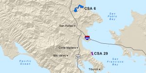 The County of Marin Department of Public Works manages County Service Area (CSA) #6 for the Gallinas Creek community. This CSA is governed by the Marin County Board of Supervisors which appoints a five-member board to the CSA #6 Advisory Board. The Advisory Board advises the Board of Supervisors on all matters relating to projects, programs, and budgets of CSA #6.
The CSA #6 boundary includes properties along the south fork of the Gallinas Creek extending downstream to Bucks Landing off North San Pedro Road, including properties in the neighborhoods of Marin Lagoon and Santa Venetia. A portion of the basic property tax (ad valorem tax) is secured for CSA #6 from the properties in the CSA #6 boundary to raise funds for periodic dredging of the main creek channel for recreational boating purposes, including a smaller channel around Santa Margarita Island. Prior dredging episodes occurred in 1966, 1973, 1981, and 1992-1994.